
Tropical Water & Ecosystems

Scott Morrissey
- Research Officer
- scott.morrissey@jcu.edu.au
Tim Smith
- Senior Research Officer
- tim.smith2@jcu.edu.au
Alejandro Navarro Otero
- Casual Research Worker
- alejandro.navarrootero@jcu.edu.au
Jack Koci
- Principal Research Officer
- jack.koci1@jcu.edu.au
Sarah McDonald
- Senior Research Officer
- sarah.mcdonald@jcu.edu.au
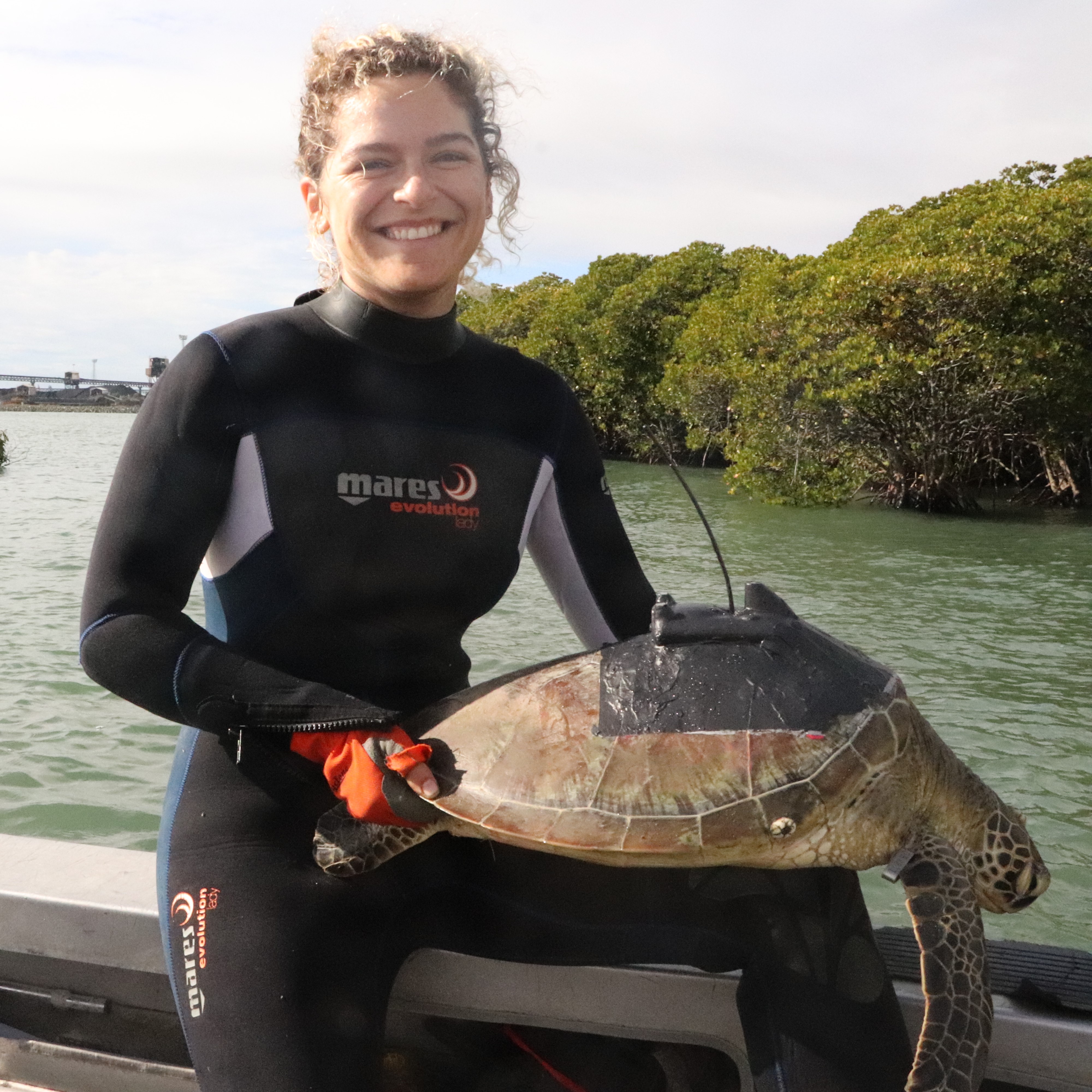
Emily Webster
- Research Officer
- emily.webster1@jcu.edu.au

Abbi Scott
- Senior Research Officer
- abbi.scott1@jcu.edu.au

Catherine Collier
- Principal Research Officer
- catherine.collier@jcu.edu.au

Rob Coles
- Principal Research Scientist
- rob.coles@jcu.edu.au

Aaron Davis
- Principal Research Officer
- aaron.davis@jcu.edu.au
Applying environmental DNA (eDNA) methods for Yellow crazy ant detection, a sensitive and less labour-intensive approach to invasive ant detection. (Old ID 27191)
Cecilia Villacorta Rath
16 Apr 2021 - 30 Apr 2025
Invasive invertebrates in Australia are estimated to impact agricultural production losses by $4.7 billion annually and cost up to $8 billion annually considering all impacts and expenses. More specifically, invasive ants are a significant threat to agricultural production, biodiversity, tourism, personal property, and local business and industry. Current methods for invasive ant detection (i.e. baited traps or cards, pitfall traps, and detection dogs) rely on trapping, smelling, or sighting active individuals and are therefore labour-intensive, costly, and highly reliant on weather conditions. The proposed project will apply environmental DNA methods for yellow crazy ant (YCA) detection. YCA has been listed as a high priority species under the National Invasive Ant Biosecurity Plan 2018-2028, and will be used as a case study. The proposed methodology could be applied to the existing infestations and taken up by farmers, as well as being applied to other terrestrial pests.
Seagrass thermal stress risk model for the inshore Great Barrier Reef. (Old ID 27720)
Catherine Collier
27 Jun 2022 - 30 Jun 2026
Seagrass meadows are at risk from decline caused by thermal stress, and this will impact the ecosystems and communities who depend on the goods and benefits they provide. There is currently no spatial and temporal product that indicates seagrass exposure to thermal stress. This proposal outlines a staged project that will deliver a model of thermal stress risk. Working in collaboration with First Nations rangers, temperature loggers will be deployed across thermal exposure gradients in the inshore Reef. These data will be used to calibrate and validate a seagrass thermal stress risk model for the inshore Reef.
IMR Integrated Reef Fish Monitoring Program (Old ID 27813)
Alexandra Carter
07 Sep 2022 - 30 Dec 2024
While critical knowledge of the abundance, diversity, and assemblage composition of Great Barrier Reef reef fishes has been delivered by comprehensive and systematic monitoring programs across various spatial and temporal scales to date, significant knowledge gaps remain. The Integrated Reef Fish Monitoring Program will address these critical knowledge gaps by establishing monitoring in nursery seascapes, deep-water inter-reef habitat, inshore fringing reefs, and developing indicators of reef fish status and trend.
Reducing nitrogen runoff without reducing industry productivity (Old ID 26960)
Aaron Davis
01 Jan 2020 - 10 Dec 2020
Many NESP TWQ Hub projects have contributed to an improved understanding of nitrogen (N) management in sugarcane farming leading to reduced dissolved inorganic nitrogen (DIN) losses via improved management advice and practical solutions. The synthesis project will bring together a range of approaches that are addressing mechanisms for reducing N-losses, with a particular focus on real-time water quality monitoring, detection of N- loss hot-spots, on-farm N management, reef credit trading and other economic levers that incentivise improved farm management practices.
Review of Glencore Water Quality Monitoring (Old ID 24938)
Shelley Templeman
01 Feb 2018 - 31 Dec 2018
The quality of water discharges from the Glencore Bulk Storage and Handling Facility at the Port of Townsville is managed through an on-site treatment system comprising gravity stormwater filters and a centralised first-flush treatment facility. The specific objective of the review is to assess current water quality monitoring arrangements and provide advice on monitoring infrastructure/practices and data evaluation to ensure Environmental Authority compliance. However it also advances wider research aims concerned with the development of more targeted water quality guidelines and compliance assessment processes for tropical systems subject to extremely variable patterns of rainfall and runoff.
Carbon sequestration value of mangroves (Old ID 25014)
Norm Duke
01 Apr 2018 - 31 Dec 2018
This project involves a field and laboratory investigation by Mackay Christian College Grade 11 students of the carbon storage potential of mangrove environments in the Pioneer River and Mackay region. Based on field sites established by Dr Duke around 15 years ago associated with an incident of severe mangrove dieback, the Senior Biology class students will collect and assess data from water sampling, field quadrates and laboratory samples. The sampling design will focus on carbon acquisition and changes over time. Some focus will also include a review of the current status of previously damaged mangrove strands. During the project, community stakeholders from local and state government plus educational and environmental conservation groups will be involved and informed as the project develops.
The Daintree's Hidden Coastline (Old ID 25049)
Norm Duke
01 May 2018 - 15 Dec 2018
This project involves community engagement in the monitoring and assessments of shoreline condition in the Daintree River estuary in North Queensland. The participants will work with JCU scientists to conduct shoreline evaluations and field surveys of forest mangrove forest biomass. These measures will identify the condition of tidal wetland habitat, the factors causing change, and the health of this major Wet Tropics river.
Baseline monitoring and evaluation of long-term impacts on fish stocks from coral restoration (Old ID 25137)
Ian McLeod
27 Aug 2018 - 30 Jun 2021
Most coral reefs in the Philippines and elsewhere in SE Asia are degraded or highly threatened by human activities, which jeopardises food security. Previous ACIAR funded projects have successfully re-established multiple breeding coral populations on highly degraded reefs. This project will assess the impact of these and scaled-up coral restoration projects on local fish populations.
Effectiveness of gully remediation in catchments draining to the Great Barrier Reef (Old ID 27084)
Jack Koci
23 Oct 2020 - 30 Jun 2021
Gully erosion is a globally significant land degradation problem and major contributor to poor water quality in the Great Barrier Reef (GBR) World Heritage Area. Gully rehabilitation can stabilise erosion and reduce downstream sediment yields, but the globally observed responses to rehabilitation are variable. This project will evaluate sediment yield and vegetation responses to several gully rehabilitation measures implemented in the Burdekin River catchment. The project will provide valuable new knowledge and understanding of the effectiveness of gully rehabilitation in savannah rangeland landscapes tributary to the GBR, and elsewhere in the world.
Desk-based feasibility assessment of using satellite images to detect and track the large dugong groups (> 100 dugongs) around Hawar Islands
Christophe Cleguer
01 Feb 2024 - 01 Jul 2024
The services will be primarily focused on conducting desk-based feasibility assessment of using satellite images to detect and track the large dugong groups (> 100 dugongs) around Hawar Islands through performing the following tasks in close coordination with the local specialists designated by the Centre:
(1) • Review and considerations for the use of satellite imagery to detect marine mammals: challenges in detecting small-bodied marine mammals using satellite images
(2) Case study: using drone aerial footage of dugong herds from Exmouth Gulf (Australia) and drone and satellite imagery (readily available and free) from Bahrain to assess the feasibility of detecting dugong herds in satellite imagery.
(1) Case study: using aerial footage of dugong herds from Exmouth Gulf (Australia) and Bahrain to assess the feasibility of detecting dugong herds in satellite imagery.Evaluate available and accessible large dugong group aerial footage across their range (e.g., Arabian Gulf and Australia) to calibrate with satellite imagery.
Performance of the services outlined in (2) by the Second Party is subject to the First Party providing the Second Party with all required drone and aerial imagery from Bahrain at least one calendar month before the due date for the final report
Coral decline threatens fish biodiversity in marine reserves
- 2004
- National Academy of Sciences
- Researchers:Maya Srinivasan
Mid-late Holocene sea-level variability in eastern Australia
- 2008
- Wiley-Blackwell
- Researchers:Stephen Lewis
Start Date:
01 Jan 2022
End Date:
01 Jan 2024
Title:
Peer Reviewer
Start Date:
01 Jan 2024
End Date:
01 Jan 2024
Title:
Peer Reviewer
Start Date:
01 Jan 2024
Title:
Peer Reviewer
Start Date:
01 Jan 2024
End Date:
01 Jan 2024
Start Date:
01 Jan 2024
Title:
English
Start Date:
24 Aug 2022
Title:
Are stingrays actually dangerous? 3 reasons you shouldn’t fear these sea pancakes, The Conversation
Start Date:
11 Jan 2023
Start Date:
28 Jul 2023
Start Date:
09 Dec 2025